Editorial: Sinking areas of Marin need constructive strategy, practical plan
March 17, 2025
PUBLISHED: March 12, 2025 at 12:59 PM PDT
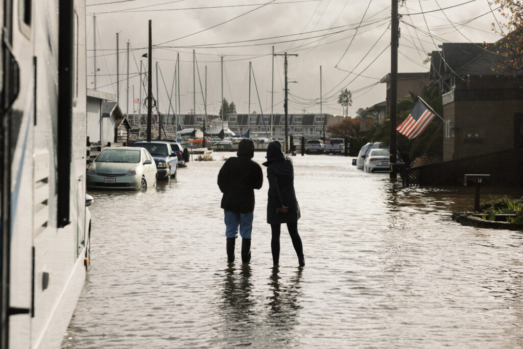
Parts of San Rafael and Corte Madera are sinking as the threat of sea-level rise grows.
It’s happening slowly, but it’s happening. In some cases, that rate is accelerated, mostly due to compaction of the bay mud landscape on which they were built, according to a report by the National Aeronautics and Space Administration.
That means an increased threat of flooding.
The San Francisco Conservation and Development Commission’s study on preparing Bay Area communities for rising sea levels says Marin faces $17 billion in expenses to build adaptive and protective projects to protect low-lying areas from inundation.
San Rafael is in the midst of a study on how to protect vulnerable areas – primarily the Canal neighborhood and areas lining San Rafael Creek.
The vulnerability of these areas and that many of the residents who live there are among those facing the greatest economic vulnerabilities should make this work a top priority.
Corte Madera is seeking a $900,000 grant from the Federal Emergency Management Agency’s flood mitigation assistance program for work needed to come up with plans to strengthen and raise the flood-protection berm that protects the Marina Village neighborhood and nearby businesses and homes.
The cities not only have to plan for bolstering protection, but having emergency plans in place and ready to implement to respond to flooding.
As Kate Hagemann, San Rafael’s climate adaptation planner, put it, the simultaneous combination of higher tides and sinking properties speeds the timing and risk of flooding. It also makes getting to work on the dilemma more urgent.
Many of these areas are already flood prone and the risk is that the scope and depth of the inundation could increase.
In some cases, some of these areas were flood prone when they were developed. Fill – dredge spoils and mud – was brought in to cover marshy areas to build homes and commercial properties, but those foundations are sinking due to historic compaction.
The NASA study used its Global Navigation Satellite System stations to provide “precise measurements of land movement and can detect both the slow, steady movements of land and sudden shifts due to short-term processes.”
The study also confirmed similar settlement has been found in San Mateo County’s Foster City, and Bay Farm Island in Alameda County.
Clearly, Marin is not going to come up with the estimated $17 billion need for protective measures.
But officials are working on a constructive strategy to come up with a practical plan to address this dilemma.
Appropriately, San Rafael has been working with the Multicultural Center of Marin and the Canal Alliance, two groups that serve Canal neighborhood residents, in coming up with a plan. Residents and property owners have a stake in this threat and they need to be partners in coming up with a practical strategy.
The worry is that as time goes by, the threat worsens, albeit slowly. But NASA’s latest report confirms previous studies clearly outlining the problem, one that exists today and is expected to grow worse with time.